SELF CARE by Three Magnets Brewing releases Gearhead IPA in partnership with the Trail Running Film Festival. Get Yours.
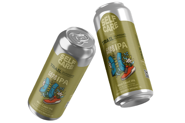
SELF CARE by Three Magnets Brewing releases Gearhead IPA in partnership with the Trail Running Film Festival. Get Yours.
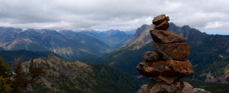
Discovering peaks deep in the Olympic Wilderness
For several month now, I’ve been sitting on this story.
I’ve not been talking about this trip much, and neither has Doug, because, well it didn’t go as well as we would have liked.
On one of our first trips in 2015, Doug and I headed out to see if we could grab a peak very early in the season. The weather wasn’t great, and we didn’t get a ton of awesome pictures, but that wasn’t the reason we didn’t write about it. The real reason was, that we descended down the wrong ravine and ended up having to bushwhack ourselves back to the trail. To this day, we still have scars on our legs to remind us about it, but I’m getting ahead of myself.
With the first sunshine of 2015 and little snow this winter, I begged Doug to focus our attention on the Staircase region. Why drive endless hours to get to some basin or another lake, when there are peaks one can grab close by – so was my reasoning.
Copper Mountain, at 5425 ft / 1654m on the Olympic Peninsula doesn’t sound like a very romantic destination. It’s a peak, or rather a group of three peaks, just south of Mt. Ellinor with decent prominence. The main deterrent to getting there is a crappy trail, as we would find out.

Our day began early with the usual coffee stop before heading toward Hoodsport, where we got stuck in an unusual traffic jam. That morning, dozens of trucks lined the road to catch their share of the just-opened Spot Shrimp season. Their goal was simple. Get the boat in the water, catch some scrimp and drink some beer. Ours, as it turned out, was a bit more complicated.

Like many of our adventures this year, we began at Staircase, the Olympic National Park entrance on the South East corner of the Olympic Peninsula. Just over an hour away from our hometown Olympia, it promised to be a short day. Copper Mountain is easiest reached via the Wagonwheel Lake Trail, which starts at the upper parking lot at Staircase.
The trail to Wagonwheel Lake is one of the steepest in the Olympic National Park. It’s just shy of 3 miles with an elevation gain of 3200ft. to reach the lake. The steep trail winds itself up several switchbacks through dense forest. Our first pit stop was an unassuming, and dare I say boring lake that feels very “back-country-y.” If you come up here all the way because some guidebook calls this lake a great destination, you might be disappointed, I certainly was.
At WagonWheel Lake, there’s no sign, no bench, no proper campsite. I know I might sound like a grump, but lakes aren’t really my jam. I breeze past them and head for the peaks.
On this day, we wanted to do just that. Once we reached the lake the trail stops. Ok, the trail vanishes completely. This would be my first experience bushwhacking in the wilderness and route-finding to a reasonably remote peak on the Olympic Peninsula. I was ready for it, but not as prepared as I should have been.
Where I grew up, in the European Alps, trails are well-marked and well-documented. Trail markers in Europe don’t just offer miles (or kilometers), but also estimated hours to your destination. Having grown up with those amenities, I expect them and they make me feel safe. Heading into the wilderness here in the U.S., I feel like the first person on the moon. I don’t know what to do.

Doug was more prepared, with topo maps in his back pocket. We hadn’t yet discovered the ever so fantastic Topo Maps+ app for the iPhone, which surely would’ve helped us not entering the wrong drainage on the way down.
It got pretty steep and we dealt with loose rock and some exposed sections, which called for some concentrated footwork. In general, going uphill is always easier than bushwhacking. With every step you head further away from thickets, the thistle-lined brushes and bushes that make walking difficult. Once you’re beyond the tree-line, nothing hinders your sight and a mountain peak is usually an obvious destination. On our first peak, (the smallest of the three) we took a rest, had lunch, snapped a few pictures, and surveyed the rest of our route. We didn’t bring climbing gear or have the experience which would’ve allowed us to high traverse straight to the second peak. Instead, to reach our next peak, we had to drop back down from the first peak into a valley with big boulders and a few lingering snow patches. From there, we aimed for the second peak. At this point, we thought it was the highest of the three. We first tried ourselves on a northeast approach, but got boxed in at an incredible steep and loose rock-filled headwall. The scrambling turned quickly into serious climbing and neither of us were really ready for this. Somewhat disappointed, we were almost ready to give up. Turning west, we found a snowfield and we were able to scramble up, holding on to small tree branches and kicking in deep, secure steps. It seemed like lost mission at this point, but once we were up the snowfield, the saddle opened up. After climbing over a few smaller boulders, we were standing on top. Yeah, we quickly realized this was ‘just’ peak two, the smaller one. We hadn’t really reached the official peak of Copper Mountain. But two of three peaks ain’t so bad in my book.
When you’re route finding and traversing from one peak to another, you usually don’t just go back the way you came from. The way down often means finding a new route, one you haven’t been on. This can prove itself to be difficult, especially when you’re starting to get tired and going downhill seems so easy and obvious.

Quickly losing elevation, we descended the same snow field we scrambled up. We cleared the big boulder field and then had to divert from the way we came by making a decision on which of several grassy mini-valleys we should descend. All we wanted to do was make our way back to Wagonwheel Lake. We weren’t quite sure which one would lead us back and we didn’t have a GPS, just a paper map and gut feeling. Once we descended into the trees, the branches and bushes made our progress difficult; our movement wasn’t as quick anymore. We didn’t freak out, but the fresh bear scat we found everywhere didn’t help. As we wandered in the woods, we both started thinking that this is not what would be considered a great outdoor experience. Doug and I both wore just shorts and the branches scratched up our legs pretty good. Luckily, those were the only scars we took from this adventure. Several hours into the trip, you start to be exhausted and you realize it’s not easy and straightforward anymore. That’s when you really have to pull yourself together. You have to be honest with yourself and with your partner, but you can’t let the situation rule you. You definitely cannot let out any growing frustration on your partner. This is a time for calm communication.
Looking at his topo maps and his Suunto watch, he realized that we realized we were below where the lake should be, according to elevation. On our way down, we had lost too much elevation and had to backtrack uphill to reach the lake. We had descend one of the many little valleys with a small stream, which seemed like it was feeding the lake; we had picked the wrong one. This was very annoying. We needed to get back to the lake to connect to the actual trail, which would lead us back to the trail head and parking lot. So up we scrambled, climbing over downed trees and through thick bushes. It was hard work, it was totally not fun, and we wasted over an hour.
Boy, were we relieved when we reached the lake. This was probably the first time I was ever excited to see a lake, ha. We didn’t linger for long, but headed straight down the trail, happy to have found it again. One thing that’s great about those steep trails is that going downhill turns into a trail run. Just let it roll, remember?
I had reached two peaks and made it back in one piece. Along the way I learned a few things:
Those are practical things I learned and they will make me a better hiker and climber.
There’s something else I learned that day and that’s something that can’t be taught, only experienced.
Going beyond your comfort zone, taking risks, are an important aspect of what helps us humans grow.
Only if we stretch ourselves and allow ourselves to do new things for the first time, will we truly learn who we really are.
On the car ride home back we tried find words and express what we had just experienced. Had it been a success? Of course we weren’t beaming about this trip. You can tell. Until today neither of us had barely talked about it. It’s not that I was ashamed, it was just a different experience.
 It was a grind, not a joyride. As time passes on, I often think about this trip and now being further removed from it, I am starting to feel proud. This experience definitely made me a better hiker, a stronger climber and I feel more confident in the wilderness.
SingletrackTM - an Electric Cable Car Production © 2018 - 2026. All Rights Reserved.